| ⬅ Back to ESMP Map Home |
8th November 2024 - The Political Map, Curvature, and the most scientific method of deciding the climate ever for real believe me.What is this page about?Honestly I'm posting this in November 2024 but Most of the work was done in August. I have sort of fallen apart these last few months in a very avoidable I'm-entirely-to-blame way and I'm finally uploading all this as part of my put myself back together efforts. So, In my infinite wisdom (ignoring the fact that I am halfway through a masters degree in software engineering) I decided I wanted a map of Empires SMP Season 1 (Not my playlist) as if it were a real continent with real countries and settlements. Also rivers. Minecraft is a beautiful game but the rivers leave a lot to be desired in regards to realism. First a few points of interest I'd already decided before I started:
Note that some of these steps ran into each other because I do not have the organisational skills to take this one step at a time. Where to Begin?So I opened up Minecraft. I wanted this map to be accurate to the actual Empires SMP world. And I happen to still have the season 1 save file (Note to self, make sure I back this up to my external hard drive, it's not publicly available anymore-). I got Xaero's Minimap and World Map mods and... ESMP S1 is tiny. 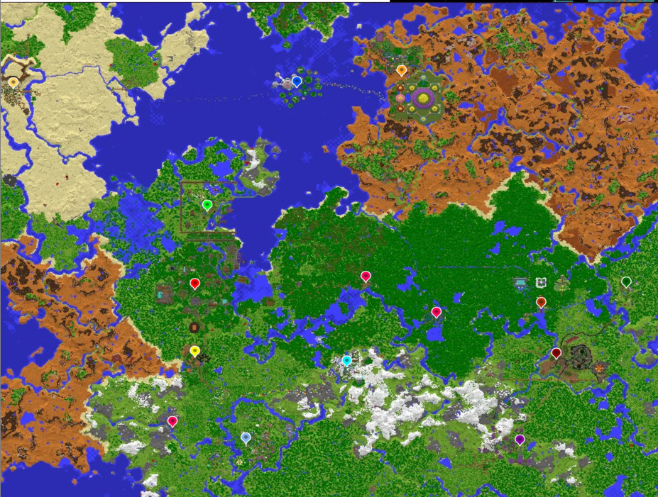
Cool, Cool. Technically, I could work with this. But prior to 1.18 large biome worlds were scaled-up versions of the small biome worlds when you used the same seed. And Yeah I could work with the small biome world. But I figured the large biome world would be closer to a realistic scale. So I flew around the whole ESMP seed on large biomes and got this: 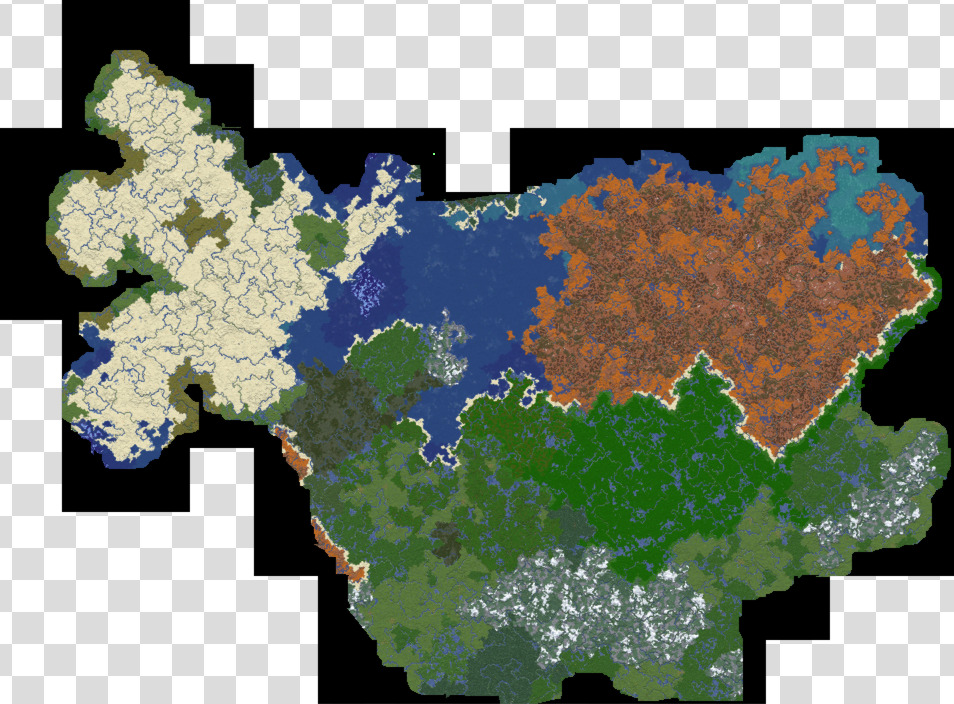
You might notice, this is a screenshot, not the full original image. That's because the image is absolutely huge (google drive can't even preview it!). I don't know why anyone would ever want this image full size unless they were as stubborn as me. Seriously opening this up in my art program of choice lags my computer more than the sims does. 
Now we circle back to the small biome map for my own sanity to solve a small but glaring issue: the climate. Why the fuck is House Blossom the southernmost country what the fuckOne of the absolutely insane (But delightful) things about the ESMP seed is that the northernmost countries are Pixandria and Mezalea (very hot!) and the southernmost countries are Crystal Cliffs and Rivendell (very cold!) with the other countries in between. Just look at this funky gradient I made that's totally based on science (not. It's just a gradient, but it does get my point across. Hot on top cold on bottom) 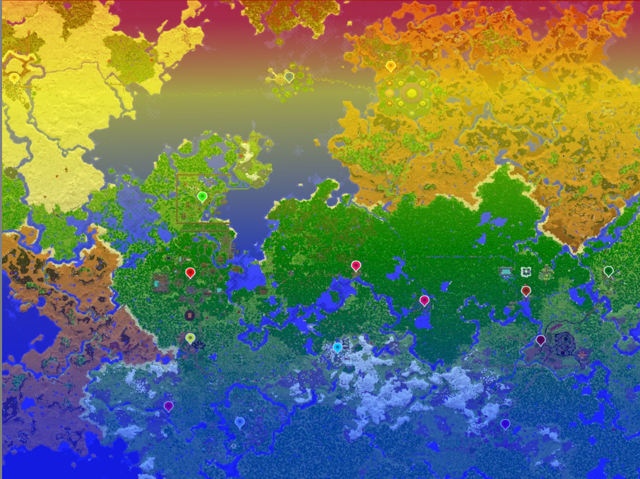
Except for House Blossom. A fact I'd forgotten until I was staring at the map. I had thought House blossom was Northwest of Rivendell and Southeast of Gilded Helianthia (functional) The most simple solution would be to move House Blossom. But that felt like cheating. I wanted an explanation for Katherine's empire being so lush and warm feeling, not to move it to justify that. Anyway after far too long thinking about it considering the simplicity of the solution, I decided the answer was the result of two factors:
All that is to say House Blossom has a lot of magic it can be warm if it wants. Scaling the map(or, the part where I did a bunch of maths and then decided to ignore most of it for my own sanity) So that's it? We have the large map, the southern hemisphere, the climate, time to start work on the actual map? Hah, no, I wanna figure out exactly how big the map is and work out how much fuckery happens due to the curvature of the planet. I already had a basic planet I'd been working on for the express purpose of minecraft worldbuilding using Atifexian's spreadsheet so I decided to put this map on that planet, do the maths, and figure ou0t exactly how big my map was. First I figured out roughly how tall the map needs to be to not reach the equator or the south pole, but still get close so we can get those hot and cold biomes, as 8804km. Next I tried to make a sphere in everyone's favourite online graphing software Geogebra to figure out the true width at the top and bottom of the map. 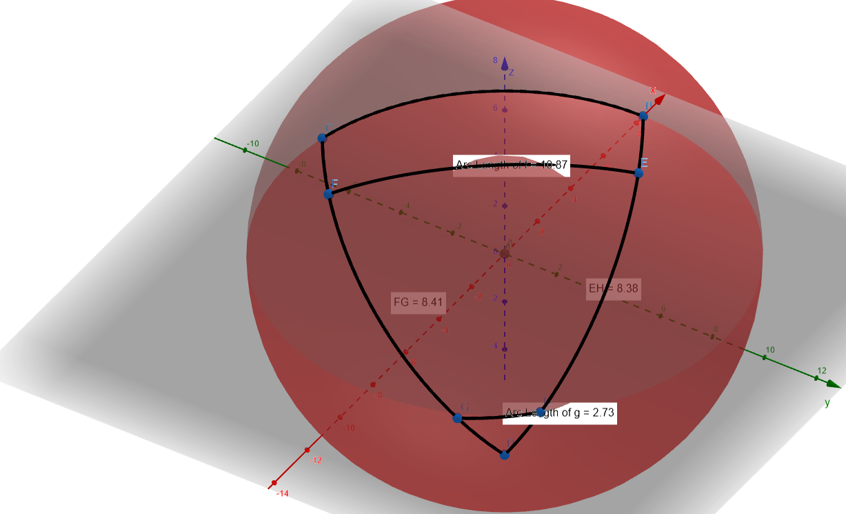
These Numbers (which I didn't save, apparently as a fuck you to the me in november for taking too long to write this I guess) in hand I attempted to 'squish' the map into proper proportions 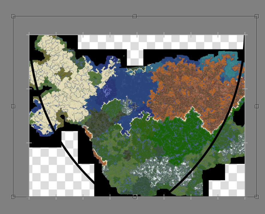 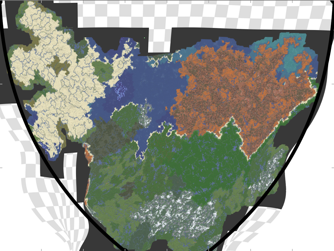
I decided curvature complicated and since the map more-or-less fit within the shape, ESMP was more-or-less already to scale, and since I calculated how tall it has to be to have both deserts and snowy mountains, I can ascertain that one pixel on the full size image (one block in my large biome world) roughly equates to 8km! Making every pixel in the game equate to approximately 0.5km. I have a mathematics degree. I'd say I hope I never have to calculate stuff like this again but I know myself well enough to know I will try calculating these kinds of things again One Day. Actually drawing a map from all of this.I decided to start with a political map. very tedious and possibly a mistake but while I was outlining I came up with and then answered several worldbuilding questions. These included:
Also of note, while I'm keeping the country names the same for now, I plan on renaming them later based on the conlangs I'm chipping away at. For this reason, most settlement names are gonna be real basic for now until I can name them properly. Also I scaled the map down to 1/4 the original size before I started drawing the country borders for the sake of my computer not dying on me. So, I present: The Political Map (as it currently stands) (No capital cities are marked) (Note these images may take a little time to load) 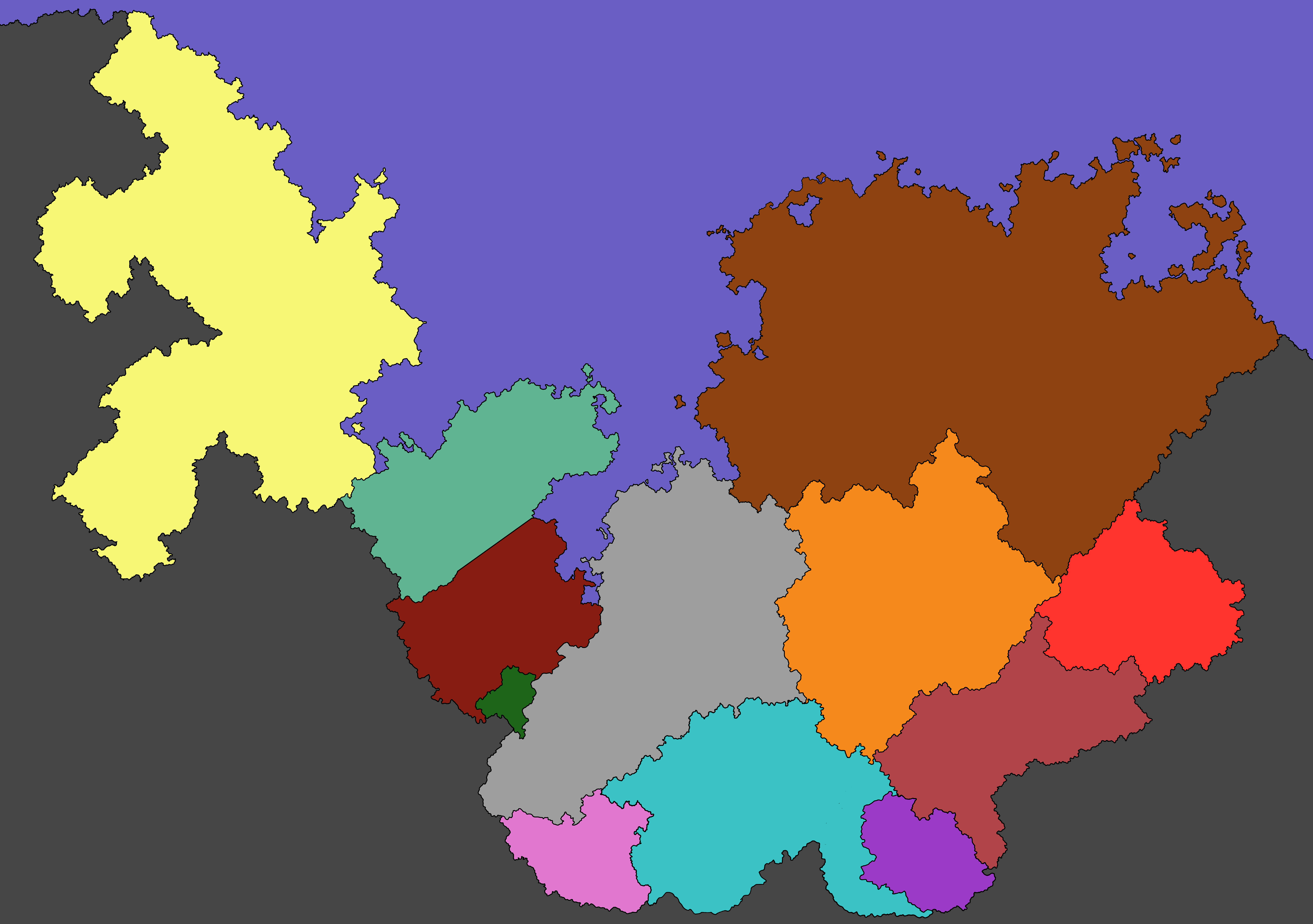 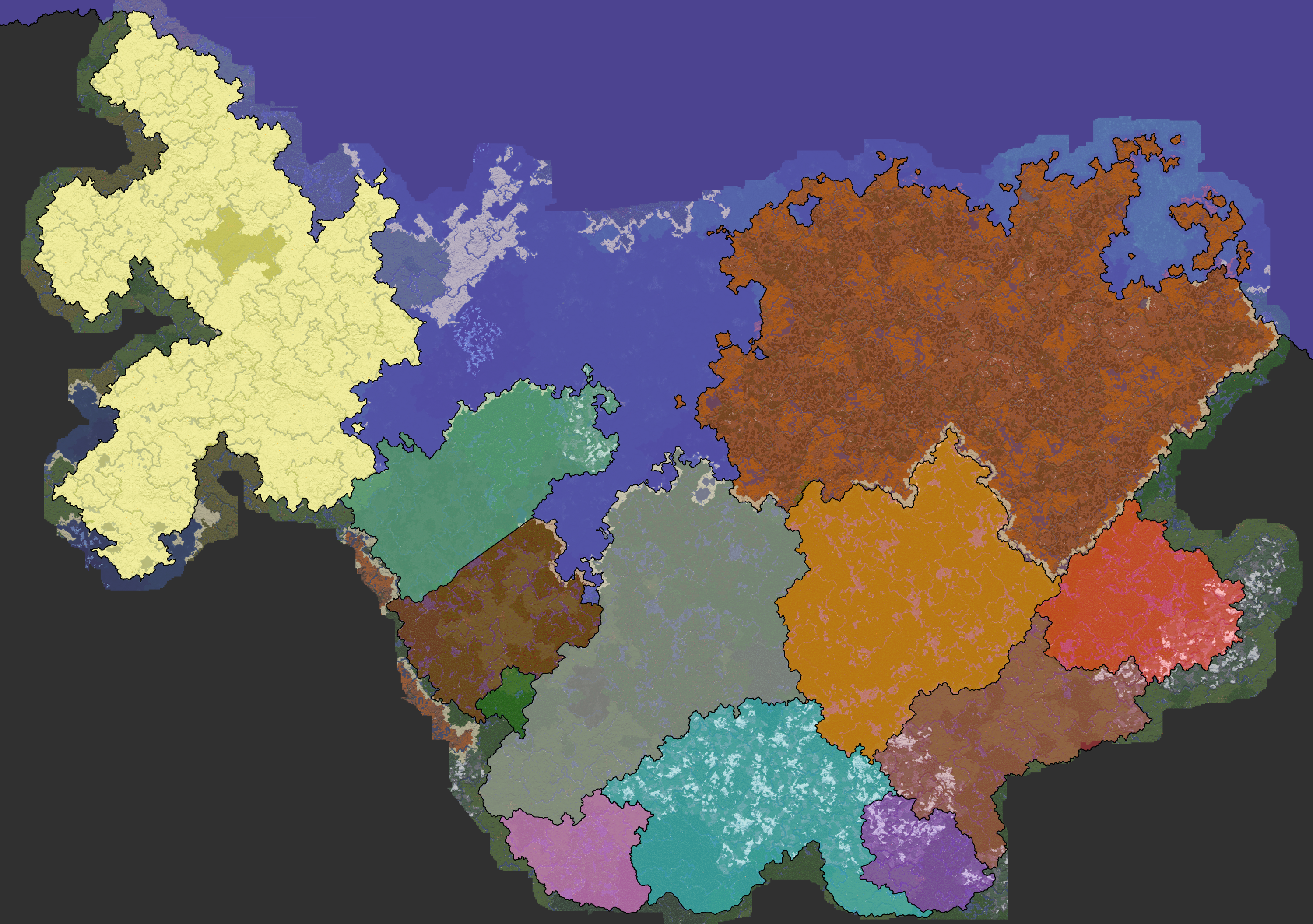
|
| ⬅ Previous Blog Next Blog ➡ |